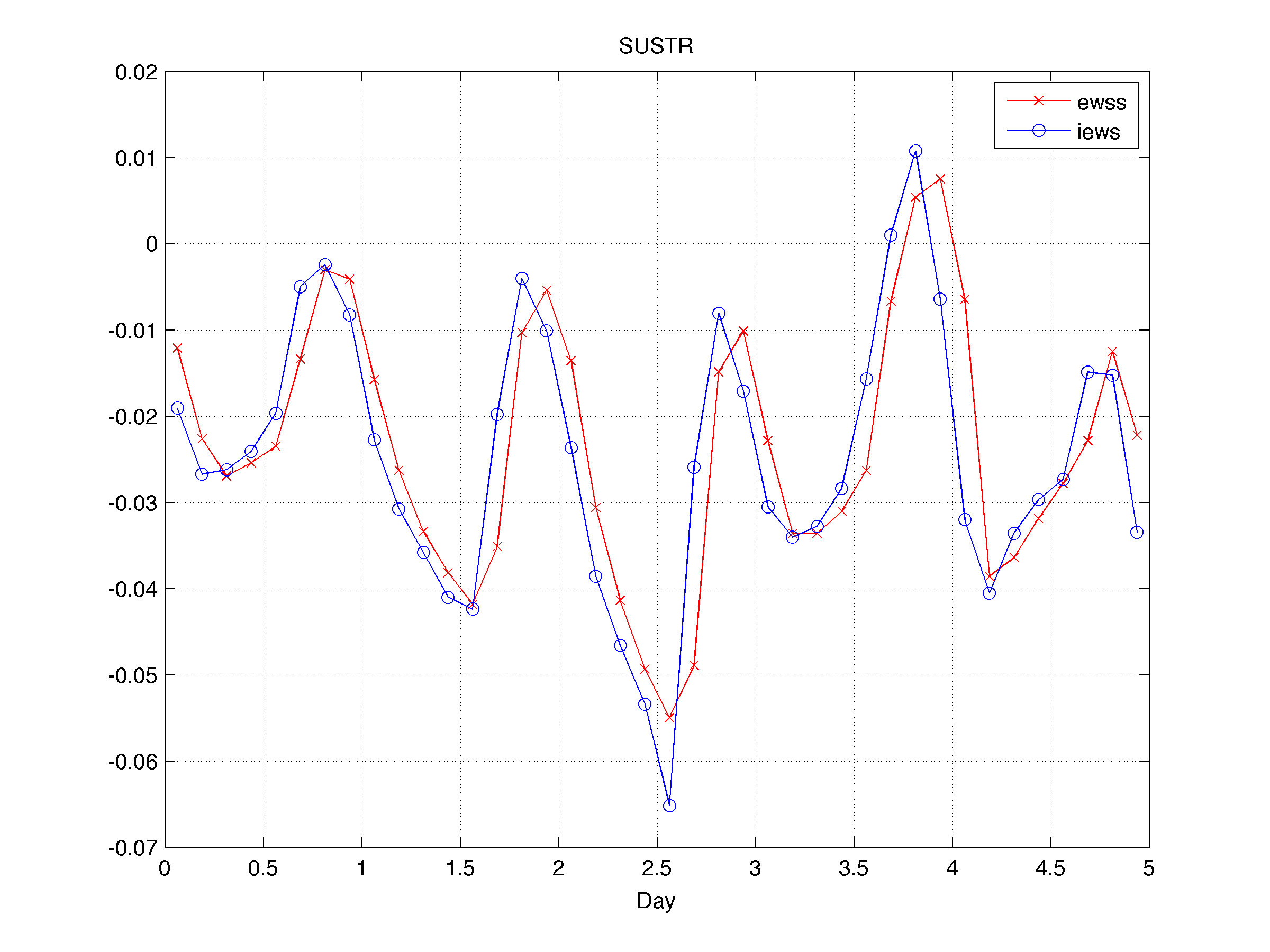
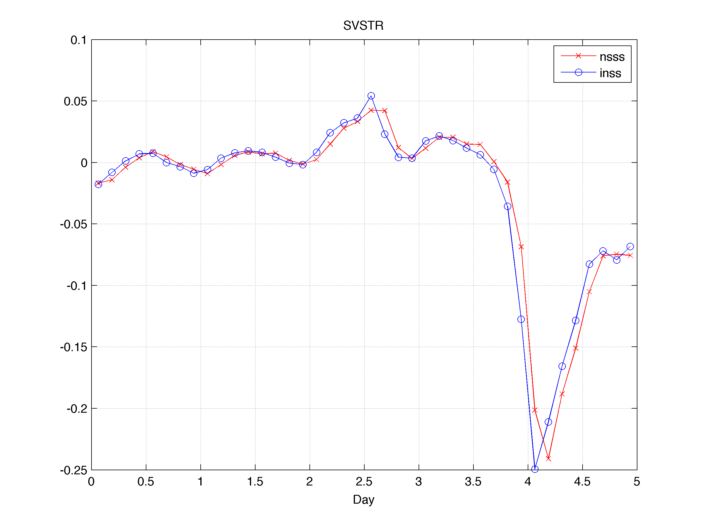
I feel like I must be doing something fundamentally wrong in my application of ROMS to the northern California current at very high resolution. Since I'm pretty much self-taught from the forums, this does not come as a huge surprise to me, but it's definitely getting to be time to look for help.
I use ROMS/TOMS version 3.6, downloaded from the myroms.org SVN repository.
I generated a reasonable 10 km horizontal resolution run for the US west coast that I'm using to provide (mostly) Rad/Nud boundary conditions for my vastly zoomed in 1 km horizontal resolution run, interpolated with the very nice MATLAB scripts provided with the ROMS package these days. My cppdefs are otherwise very similar to the 10 km run (which was forced with SODA boundary conditions); U3H/C4V TS advection, standard UV_ADV (which I believe currently defaults to 3rd order horizontal upwinding, 4th order centered in the vertical), LMD vertical mixing, Chapman boundary conditions for zeta and Flather for the mixing TKE. Both runs are surface forced with NARR data (temp, pressure, humidity, precip, winds, radiation, clouds) as put through the ROMS BULK_FLUXES formulation. NARR has its share of problems in my region of interest (too hot in the summer, too cold in the winter, winds are often iffy onshore), but nothing so drastic as to make my runs too terrible.
But at 1 km, I have some serious weirdness afoot that didn't appear in the 10 km version. The ocean is getting hot -- offshore, some 4 C warmer in the 1 km version than its 10 km boundaries, in summer -- and, after a year of spinup, I have what are effectively faux upwelling conditions (cold, saline onshore water) all year round, as my salt and temp gradients with depth rapidly lose their sensitivity to the bathymetry. My bottom ROMS layer is quite different than initialization after a year -- onshore is much colder and more saline, leading to surface conditions seemingly independent of the winds/upwelling/downwelling conditions. And while I'd expect some shifting of the ocean floor conditions in spinup, this seems a little excessive (and leads to these unrealistic surface conditions).
My Courant numbers start a bit high, but tend to quickly settle down to e-3 to e-4 horizontally and 0.1-0.2 vertically, and my grid is right on the edge of acceptable bathymetric smoothness and bottom layer depths; lately I've been running at 30s timesteps in the name of robust numerical stability at high resolution.
My surface heat retention issue looks suspiciously similar to some graphics Hernan Arango presented at last year's workshop in Rio (which I proceeded to access online), where BULK_FLUXES and Rad/Nud are combined to have heat retention and odd little zeta vortices floating around. Unfortunately, without the audio for that presentation, I'm not quite sure what the recommendation for BULK_FLUXES+Rad/Nud is. I'm inclined to infer that the recommendation is -- DON'T DO IT!! Assuming that's the case, what are people using instead these days? Should I just impose surface heat fluxes? NARR has a surface heat flux estimate, albiet without an explicit dQ/dSST term (though I could estimate dq/dt from their Q timeseries, and use the 10 km SST, or estimate with NARR's 2m air temp), which seems important from when my ROMS sea surface drifts away from NARR (which it inevitably will, I imagine). I could turn to CORE2, though its one degree horizontal resolution is awfully low for my application.
It's possible that the onshore 'fake upwelling' is connected to my surface/boundaries issue, but I have to wonder if there's something more fundamental going on with my choice and parameterization of my vertical mixing. I just used what I thought were typical, suggested parameters for LMD. I'm putting the interesting parts of the top of a typical logfile below (the full version is attached); if anything jumps out at a more experienced user as desperately wrong, I'd be very grateful for the insight. It would be wonderful if I was just being very foolish in an obvious way, with some combination of parameters or .h selections, and I would gladly accept embarrassment if I could fix the issue.
Thanks so much for your time.
Code: Select all
 Model Input Parameters:  ROMS/TOMS version 3.6
                          Wednesday - May 15, 2013 -  1:54:08 PM
 -----------------------------------------------------------------------------

 expandedroms

 Operating system : Linux
 CPU/hardware     : x86_64
 Compiler system  : ifort
 Compiler command : /global/software/centos-5.x86_64/modules/openmpi/1.2.8-

intel/bin/mpif90
 Compiler flags   : -heap-arrays -fp-model precise -ip -O3 -free -free -free

 Input Script  : expandedroms.in

 SVN Root URL  : https://www.myroms.org/svn/src/trunk
 SVN Revision  : 605:631M

 Local Root    : /global/home/users/lolhsson
 Header Dir    : /global/home/users/lolhsson/Projects/10kmrestest
 Header file   : expandedroms.h
 Analytical Dir: /global/home/users/lolhsson/Projects/10kmrestest

 Resolution, Grid 01: 0548x0498x030,  Parallel Nodes:  64,  Tiling: 008x008


 Physical Parameters, Grid: 01
 =============================

   97822080  ntimes          Number of timesteps for 3-D equations.
     30.000  dt              Timestep size (s) for 3-D equations.
         30  ndtfast         Number of timesteps for 2-D equations between
                               each 3D timestep.
          1  ERstr           Starting ensemble/perturbation run number.
          1  ERend           Ending ensemble/perturbation run number.
          0  nrrec           Number of restart records to read from disk.
          T  LcycleRST       Switch to recycle time-records in restart file.
       2880  nRST            Number of timesteps between the writing of data
                               into restart fields.
          1  ninfo           Number of timesteps between print of information
                               to standard output.
          T  ldefout         Switch to create a new output NetCDF file(s).
   32607400  nHIS            Number of timesteps between the writing fields
                               into history file.
          1  ntsAVG          Starting timestep for the accumulation of output
                               time-averaged data.
       2880  nAVG            Number of timesteps between the writing of
                               time-averaged data into averages file.
     288000  ndefAVG         Number of timesteps between creation of new
                               time-averaged file.
 0.0000E+00  nl_tnu2(01)     NLM Horizontal, harmonic mixing coefficient
                               (m2/s) for tracer 01: temp
 0.0000E+00  nl_tnu2(02)     NLM Horizontal, harmonic mixing coefficient
                               (m2/s) for tracer 02: salt
 5.0000E+00  nl_visc2        NLM Horizontal, harmonic mixing coefficient
                               (m2/s) for momentum.
 1.0000E-06  Akt_bak(01)     Background vertical mixing coefficient (m2/s)
                               for tracer 01: temp
 1.0000E-06  Akt_bak(02)     Background vertical mixing coefficient (m2/s)
                               for tracer 02: salt
 1.0000E-05  Akv_bak         Background vertical mixing coefficient (m2/s)
                               for momentum.
 3.0000E-04  rdrg            Linear bottom drag coefficient (m/s).
 3.0000E-03  rdrg2           Quadratic bottom drag coefficient.
 2.0000E-02  Zob             Bottom roughness (m).
 2.0000E+00  blk_ZQ          Height (m) of surface air humidity measurement.
 2.0000E+00  blk_ZT          Height (m) of surface air temperature measurement.
 1.0000E+01  blk_ZW          Height (m) of surface winds measurement.
          1  lmd_Jwt         Jerlov water type.
          2  Vtransform      S-coordinate transformation equation.
          4  Vstretching     S-coordinate stretching function.
 7.0000E+00  theta_s         S-coordinate surface control parameter.
 1.0000E-01  theta_b         S-coordinate bottom  control parameter.
    250.000  Tcline          S-coordinate surface/bottom layer width (m) used
                               in vertical coordinate stretching.
   1025.000  rho0            Mean density (kg/m3) for Boussinesq approximation.
      0.000  dstart          Time-stamp assigned to model initialization (days).
       0.00  time_ref        Reference time for units attribute (yyyymmdd.dd)
 3.6000E+02  Tnudg(01)       Nudging/relaxation time scale (days)
                               for tracer 01: temp
 3.6000E+02  Tnudg(02)       Nudging/relaxation time scale (days)
                               for tracer 02: salt
 0.0000E+00  Znudg           Nudging/relaxation time scale (days)
                               for free-surface.
 3.6000E+02  M2nudg          Nudging/relaxation time scale (days)
                               for 2D momentum.
 3.6000E+02  M3nudg          Nudging/relaxation time scale (days)
                               for 3D momentum.
 1.2000E+02  obcfac          Factor between passive and active
                               open boundary conditions.
          T  VolCons(1)      NLM western  edge boundary volume conservation.
          T  VolCons(2)      NLM southern edge boundary volume conservation.
          F  VolCons(3)      NLM eastern  edge boundary volume conservation.
          T  VolCons(4)      NLM northern edge boundary volume conservation.
     14.000  T0              Background potential temperature (C) constant.
     35.000  S0              Background salinity (PSU) constant.
   1027.000  R0              Background density (kg/m3) used in linear Equation
                               of State.
 1.7000E-04  Tcoef           Thermal expansion coefficient (1/Celsius).
 0.0000E+00  Scoef           Saline contraction coefficient (1/PSU).
      1.000  gamma2          Slipperiness variable: free-slip (1.0) or
                                                    no-slip (-1.0).

          T  Aout(idFsur)    Write out averaged free-surface.
          T  Aout(idUbar)    Write out averaged 2D U-momentum component.
          T  Aout(idVbar)    Write out averaged 2D V-momentum component.
          T  Aout(idUvel)    Write out averaged 3D U-momentum component.
          T  Aout(idVvel)    Write out averaged 3D V-momentum component.
          T  Aout(idWvel)    Write out averaged W-momentum component.
          T  Aout(idOvel)    Write out averaged omega vertical velocity.
          T  Aout(idTvar)    Write out averaged tracer 01: temp
          T  Aout(idTvar)    Write out averaged tracer 02: salt
          T  Aout(idPair)    Write out averaged surface air pressure.
          T  Aout(idUair)    Write out averaged surface U-wind component.
          T  Aout(idVair)    Write out averaged surface V-wind component.
          T  Aout(idTsur)    Write out averaged surface net heat flux.
          T  Aout(idTsur)    Write out averaged surface net salt flux.
          T  Aout(idSrad)    Write out averaged shortwave radiation flux.
          T  Aout(idLrad)    Write out averaged longwave radiation flux.
          T  Aout(idLhea)    Write out averaged latent heat flux.
          T  Aout(idShea)    Write out averaged sensible heat flux.
          T  Aout(idevap)    Write out averaged evaporation rate.
          T  Aout(idrain)    Write out averaged rain rate.

 Output/Input Files:

             Output Restart File:

/global/scratch/lolhsson/newnested10to1/ocean_rst.nc
             Output History File:

/global/scratch/lolhsson/newnested10to1/ocean_his.nc
       Prefix for Averages Files:  /global/scratch/lolhsson/newnested10to1/ocean_avg
                 Input Grid File:

/clusterfs/hadley/scratch/lolhsson/supersmoothroms1kmres123pt5to129W3944N.nc
    Input Nonlinear Initial File:

/clusterfs/hadley/scratch/lolhsson/supersmoothzoomout1kmini.nc
           Input Forcing File 01:

/clusterfs/hadley/scratch/lolhsson/expandedgridforcing/Pair.OREEG.19852010.nc
           Input Forcing File 02:

/clusterfs/hadley/scratch/lolhsson/expandedgridforcing/Tair.OREEG.19852010.nc
           Input Forcing File 03:

/clusterfs/hadley/scratch/lolhsson/expandedgridforcing/Vair.OREEG.19852010.nc
           Input Forcing File 04:

/clusterfs/hadley/scratch/lolhsson/expandedgridforcing/rain.OREEG.19852010.nc
           Input Forcing File 05:

/clusterfs/hadley/scratch/lolhsson/expandedgridforcing/Qair.OREEG.19852010.nc
           Input Forcing File 06:

/clusterfs/hadley/scratch/lolhsson/expandedgridforcing/Uair.OREEG.19852010.nc
           Input Forcing File 07:

/clusterfs/hadley/scratch/lolhsson/expandedgridforcing/cloud.OREEG.19852010.nc
           Input Forcing File 08:

/clusterfs/hadley/scratch/lolhsson/expandedgridforcing/swrad.OREEG.19852010.nc
           Input Forcing File 09:

/clusterfs/hadley/scratch/lolhsson/expandedgridforcing/lwrad_down.OREEG.19852010.nc
             Input Boundary File:

/clusterfs/hadley/scratch/lolhsson/supersmoothzoomout1kmbry.nc

 Lateral Boundary Conditions: NLM
 ============================

 Variable               Grid    West Edge   South Edge  East Edge   North Edge
 ---------              ----    ----------  ----------  ----------  ----------

 zeta                     1     Chapman     Chapman     Closed      Chapman

 ubar                     1     Rad + Nud   Rad + Nud   Closed      Rad + Nud

 vbar                     1     Rad + Nud   Rad + Nud   Closed      Rad + Nud

 u                        1     Rad + Nud   Rad + Nud   Closed      Rad + Nud

 v                        1     Rad + Nud   Rad + Nud   Closed      Rad + Nud

 temp                     1     Rad + Nud   Rad + Nud   Closed      Rad + Nud

 salt                     1     Rad + Nud   Rad + Nud   Closed      Rad + Nud

 Activated C-preprocessing Options:

 expandedroms        expandedroms
 ATM_PRESS           Impose atmospheric pressure onto sea surface.
 ANA_BSFLUX          Analytical kinematic bottom salinity flux.
 ANA_BTFLUX          Analytical kinematic bottom temperature flux.
 ANA_FSOBC           Analytical free-surface boundary conditions.
 ANA_M2OBC           Analytical 2D momentum boundary conditions.
 ASSUMED_SHAPE       Using assumed-shape arrays.
 AVERAGES            Writing out time-averaged nonlinear model fields.
 BULK_FLUXES         Surface bulk fluxes parameterization.
 DJ_GRADPS           Parabolic Splines density Jacobian (Shchepetkin, 2002).
 DOUBLE_PRECISION    Double precision arithmetic.
 EMINUSP             Compute Salt Flux using E-P.
 LMD_CONVEC          LMD convective mixing due to shear instability.
 LMD_MIXING          Large/McWilliams/Doney interior mixing.
 LMD_NONLOCAL        LMD convective nonlocal transport.
 LMD_RIMIX           LMD diffusivity due to shear instability.
 LMD_SKPP            KPP surface boundary layer mixing.
 LONGWAVE_OUT        Compute outgoing longwave radiation internally.
 MASKING             Land/Sea masking.
 MIX_GEO_TS          Mixing of tracers along geopotential surfaces.
 MIX_GEO_UV          Mixing of momentum along geopotential surfaces.
 MPI                 MPI distributed-memory configuration.
 NONLINEAR           Nonlinear Model.
 !NONLIN_EOS         Linear Equation of State for seawater.
 OUT_DOUBLE          Double precision output fields in NetCDF files.
 PERFECT_RESTART     Processing perfect restart variables.
 POWER_LAW           Power-law shape time-averaging barotropic filter.
 PROFILE             Time profiling activated .
 !RST_SINGLE         Double precision fields in restart NetCDF file.
 SALINITY            Using salinity.
 SOLAR_SOURCE        Solar Radiation Source Term.
 SOLVE3D             Solving 3D Primitive Equations.
 SPLINES             Conservative parabolic spline reconstruction.
 TS_U3HADVECTION     Third-order upstream horizontal advection of tracers.
 TS_C4VADVECTION     Fourth-order centered vertical advection of tracers.
 TS_DIF2             Harmonic mixing of tracers.
 UV_ADV              Advection of momentum.
 UV_COR              Coriolis term.
 UV_U3HADVECTION     Third-order upstream horizontal advection of 3D momentum.
 UV_C4VADVECTION     Fourth-order centered vertical advection of momentum.
 UV_LDRAG            Linear bottom stress.
 UV_VIS2             Harmonic mixing of momentum.
 VAR_RHO_2D          Variable density barotropic mode.


 ndtfast, nfast =   30  42   nfast/ndtfast =  1.40000

 Centers of gravity and integrals (values must be 1, 1, approx 1/2, 1, 1):

    1.000000000000 1.047601458608 0.523800729304 1.000000000000 1.000000000000

 Power filter parameters, Fgamma, gamma =  0.28400   0.18933

 Minimum X-grid spacing, DXmin =  7.99934148E-01 km
 Maximum X-grid spacing, DXmax =  8.64083464E-01 km
 Minimum Y-grid spacing, DYmin =  1.06893682E+00 km
 Maximum Y-grid spacing, DYmax =  1.15465833E+00 km
 Minimum Z-grid spacing, DZmin =  3.20533014E-01 m
 Maximum Z-grid spacing, DZmax =  8.84996407E+02 m

 Minimum barotropic Courant Number =  1.54598336E-02
 Maximum barotropic Courant Number =  3.12695104E-01
 Maximum Coriolis   Courant Number =  3.03817176E-03

 Maximum grid stiffness ratios:  rx0 =   2.807708E-01 (Beckmann and Haidvogel)
                                 rx1 =   1.282151E+01 (Haney)


 Initial basin volumes: TotVolume =  6.2618283263E+14 m3
                        MinVolume =  2.7416988319E+05 m3
                        MaxVolume =  8.6299629887E+08 m3
                          Max/Min =  3.1476699367E+03

